Preloader Close
About Us
Navgrid Limited is a forward -thinking surveying and GIS company committed to delivering high -precision geospatial intelligence solutions. We combine advanced surveying techniques, drone technology, GIS analytics, and modern geospatial systems to provide accurate, reliable, and data -driven insights that support informed decision -making across various sectors. .
Get a free quote
Welcome!... Mapping Intelligence, Delivering Precision.

Drone Mapping
20
Jul
The surveying industry has undergone significant transformation
Drone mapping enables professionals to collect large amounts of accurate data faster, safer, and more efficiently than traditional methods.
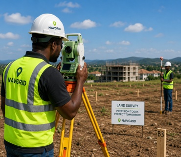
Land Surveying
10
Jul
Why Accurate Land Surveying
Before any construction project begins, one critical step determines its success: accurate land surveying. We provide precise measurements that help property owners, developers, architects, and engineers make informed decisions.

The Role of GIS and Spatial Analysis
30
Jun
In today's data-driven world, organizations need more than information
Geographic Information Systems (GIS) and Spatial Analysis transform location-based data into actionable insights that support strategic planning and operational efficiency.